Locations:
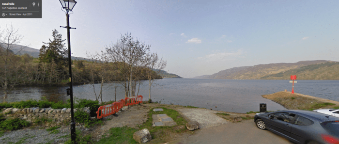
Canal Side, Fort Augustus, Loch Ness, Scotland, UK (The Tent)
Google Maps Co-ordinates: 57.146562, -4.675408

Cromarty Bridge, A9, Dingwall (North Coast 500 – approx)
Google Maps Co-ordinates: 57.611667, -4.356389

Wroughton Airfield, Swindon, United Kingdom (The Eboladrome –Jeremy Drives The Lexus) (Built in 1940 – More info)
Google Maps Co-ordinates: 51.513838, -1.795945

Wank, Garmisch-Partenkirchen, Germany (Street View Unavailable)
Google Maps Co-ordinates: 47.507801, 11.143742
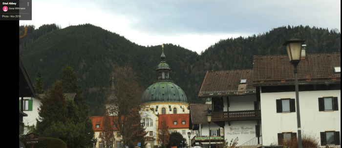
Benediktinerabtei Ettal, Kaiser-Ludwig-Platz, Ettal, Germany (Seen in the background, 31 minutes in)
Google Maps Co-ordinates: 47.569597, 11.094676

Airstrip Unknown (Still Searching…)
Kissing, Germany
Google Maps Co-ordinates: 48.302892, 10.973526

Petting, Germany
Google Maps Co-ordinates: 47.912723, 12.813886

Fucking 10, Austria (Richard and Jeremy sit in James’ Bentley)
Google Maps Co-ordinates: 48.067552, 12.862833

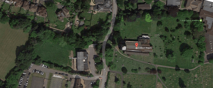
St Mary’s Reigate, Chart Lane, Reigate, UK (Porsche Launch Control)
Google Maps Co-ordinates: 51.236711, -0.197260

Zeppelin-Tribüne, Beuthener Straße, Nuremberg, Germany (“This is not the nurburgring”)
Google Maps Co-ordinates: 49.431510, 11.125010

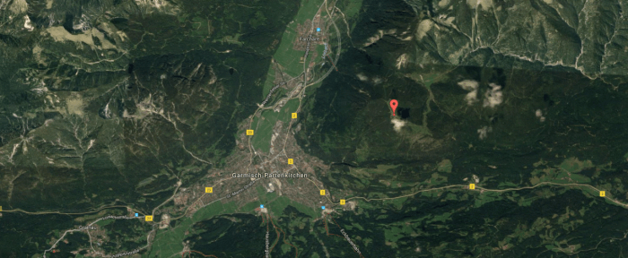
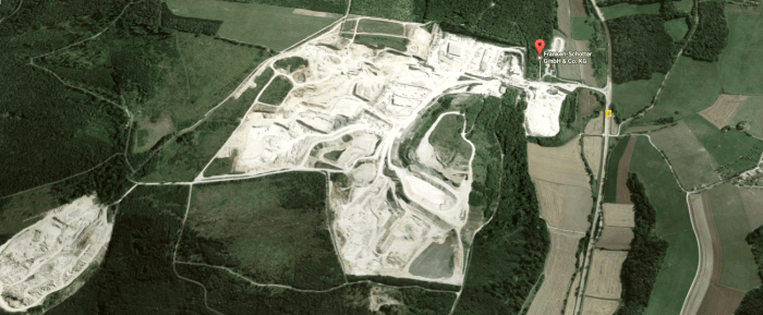
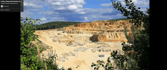
Franken-Schotter GmbH & Co. KG, Treuchtlingen, Germany (Many thanks to Marcel for finding this location)
Google Maps Co-ordinates: 48.923475, 10.920007
Series 1, Episode 12
Cast: Jeremy Clarkson, Richard Hammond & James May
Episode 12 Trailer


I’m 99% sure I found the quarry. The company is called Franken-Schotter GmbH & Co., and it’s located about 40 km almost directly south of Nuremberg. The nearest town and mailing address is Treuchtlingen, and the town of Langenaltheim just to the south is also visible in some of the aerial photography on the show (as well as a couple of windmill generators). The coordinates of the entrance to the quarry from the regional road are 48°55’25.55″N, 10°55’1.30″E.
Unfortunately the newest imagery Google Earth has of the area is from 2007 or 2008, but if you pause the episode at 58m06s, this aerial view seems to be looking almost straight southwest, and Langenaltheim appears in the upper left corner of the image. It looks a little different on Google Earth as they’ve obviously done more excavation in the last 8 or 9 years, but the overall shape is the same. I think this is it.
LikeLiked by 1 person
Thank you Marcel for your finding. I’ve compared the two and it does seem that that is the quarry they used. I appreciate your hard work in finding it, ill be sure to credit you now when I edit the post 🙂 and again, thank you
LikeLike
Pingback: Top Posts For January 2017 – Global Film Locations